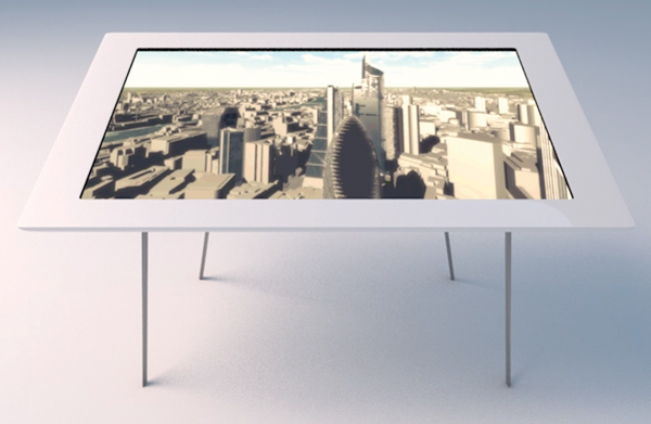
On Tuesday I was invited to visit Wagstaffs Design in London to take a look at their latest product VUCITY. Powered by the Unity game engine, VUCITY offers an interactive 3D model of London that can be deployed to a touch screen table, video wall, tablet or desktop computer as required. The standalone application enables users to rotate and view the entire scene and zoom down to the scale of individual buildings.
Currently VUCITY covers 80 square kilometres of Central London, from Earls Court in the west to the ExCeL exhibition centre in the east, and from Old Street in the north to Battersea in the south. The project is a joint venture between Wagstaffs and Vertex Modelling who are able to provide high detail 3D models of the London area. Created from high resolution imagery the models boast an average accuracy tolerance of 40mm compared with full measured surveys. This degree of accuracy is particularly important for viewshed analysis and visualisation proposed as a possible application in Wagstaffs’ promotional video:
Over time Wagstaffs are seeking to integrate a range of data including data on demographics, property prices over time as well as live data streams for transport. The inclusion of real-time data is possibly the most exciting aspect of the project but also holds the biggest challenge. This is a fantastic project and I’ll be following it keenly. I thoroughly recommend heading over to the Wagstaffs’ website to check out VUCITY and their other great projects today.
